Weather Integration
Published on May 16, 2022 by Jared Rada · 2 min read
Weather information is now directly integrated into SeaDrive! Being a mariner also means being a weatherman- it’s important to know about the winds, heavy seas, or lightning activity for the safety of you, your crew, and your vessel. So we’ve made it easy to look up current and future forecasted weather conditions directly in SeaDrive. Since SeaDrive is an app for mariners we’ve made sure to include weather data points pertinent to those who enjoy being the water.
Standard weather information like temperature, precipitation, cloud cover, and wind (wind speed, wind direction, gusts) are included, but we’ve also embedded wave and swell data. If you request weather for any point in the ocean we’ll display the swell size, swell direction, and swell period. For the more technically inclined the actual data used for swell size is the “significant swell height” which is inclusive of both the wave and swell height and is generally representative of the conditions you’ll see at sea. This data point is not available for rivers, smaller bays, sheltered sounds, or anywhere inland as the underlying data model is NOAA Wave Watch III. It’s simply not feasible to get accurate swell prediction data for these areas and the swell display in the weather section will be empty. We hope the weather data points are useful to you and we welcome any feedback.
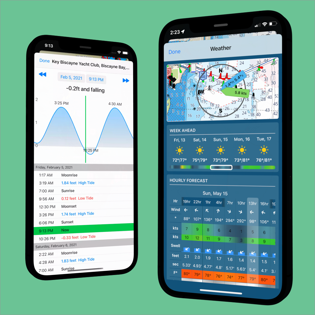
How do you use the new weather feature? It’s simple, just swipe up the info panel and tap the Weather button. You’ll see a mini map with wind and swell vanes, a daily forecast, and a detailed three hour incremental forecast. You can swipe left and right to see other forecasts times and the mini map’s wind and swell vanes will animate in real time. You can view weather forecasts for up to five days in the future.
We plan to do much more with weather in SeaDrive. In the near future we plan on adding radar/precipitation overlays directly on the navigation charts. We believe we’ll be the first handheld chart plotter to offer this feature and we’re working with NOAA to make it a reality. We also plan to add a wind animation layer which will help sailors with route planning. Stay tuned for future updates on both of these features.