It's like Google Maps for boats.
Charts, weather, tides... everything you need in one place.
Over 10,000 downloads
4.6 out of 5 stars
“When I found myself at night and in unfamiliar waters, I had one friend checking the water depth with a pole and another friend looking for a boat nav app. Luckily we found SeaDrive. We were able to navigate home and I've been a SeaDrive user ever since.”
It really is like Google Maps for boating!
Depth and soundings are accurate, works well off the coast. It's the best water nav app I found.
Simple & intuitive
SeaDrive is dead simple to use and has free chart data and offline downloads. Finally a modern boat navigation app!
Fantastic App
I use SeaDrive everyday fishing in the Long Island sound, usually around Block Island or Newport. Great for tides, winds, weather. I mark all my favorite fishing spots and use the live location sharing when my buddies are out on the water. Great app. 5 stars!
RAD NAV APP
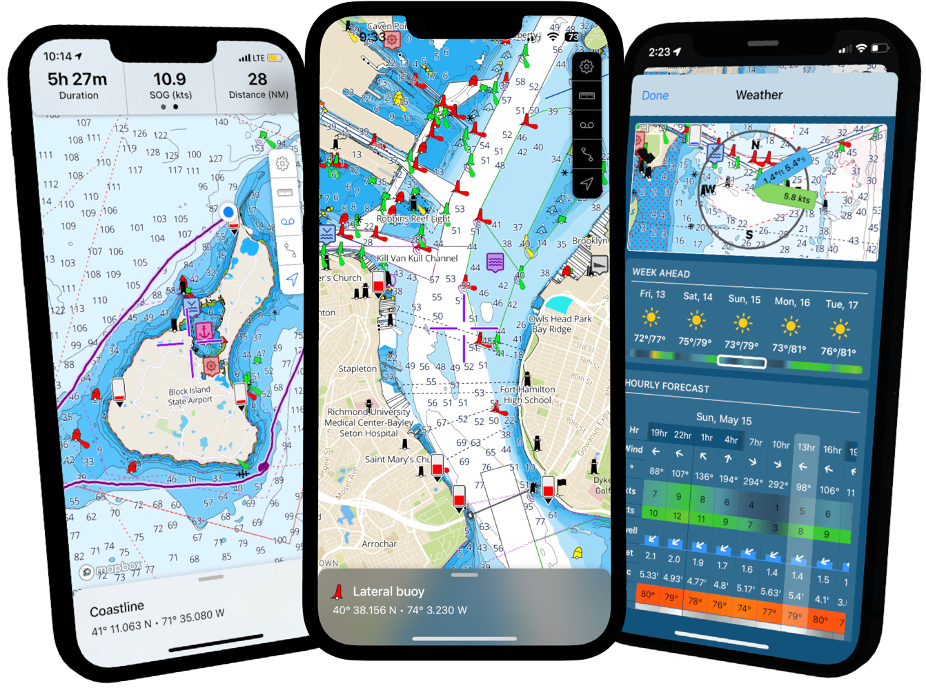
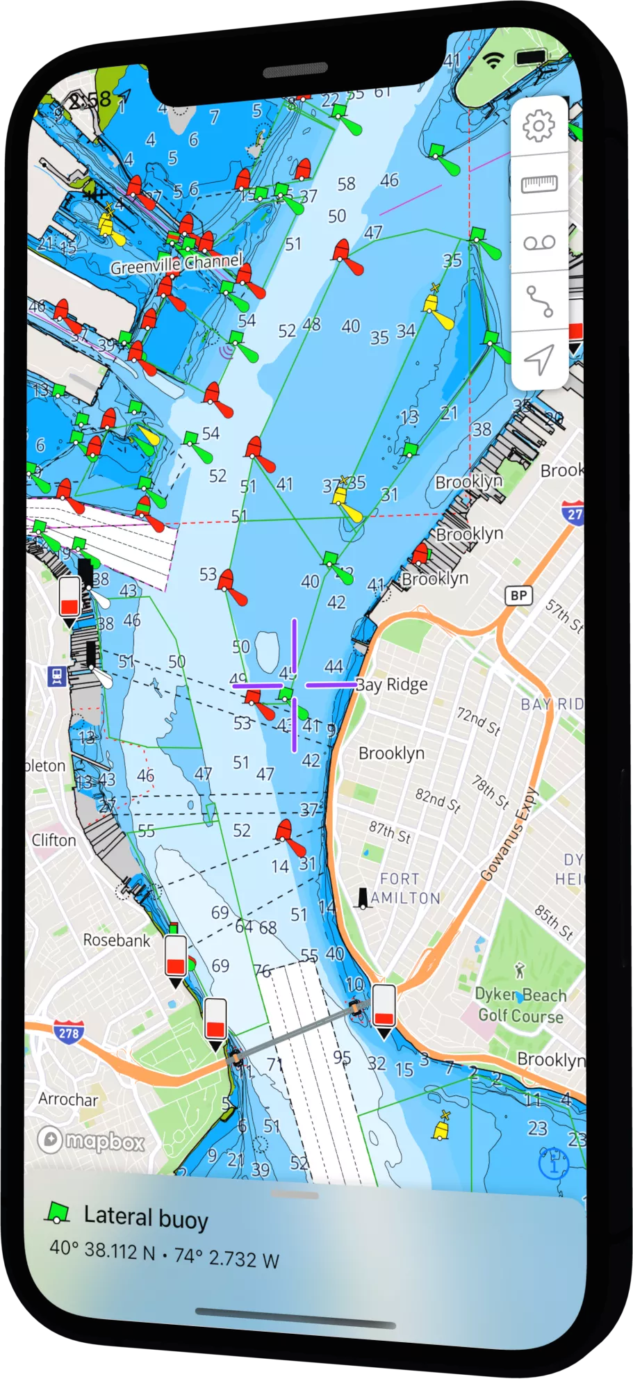
Free US Charts
You already paid for charts with your tax dollars. Why pay twice? SeaDrive gives you unlimited access (both online and offline) to all NOAA charts.
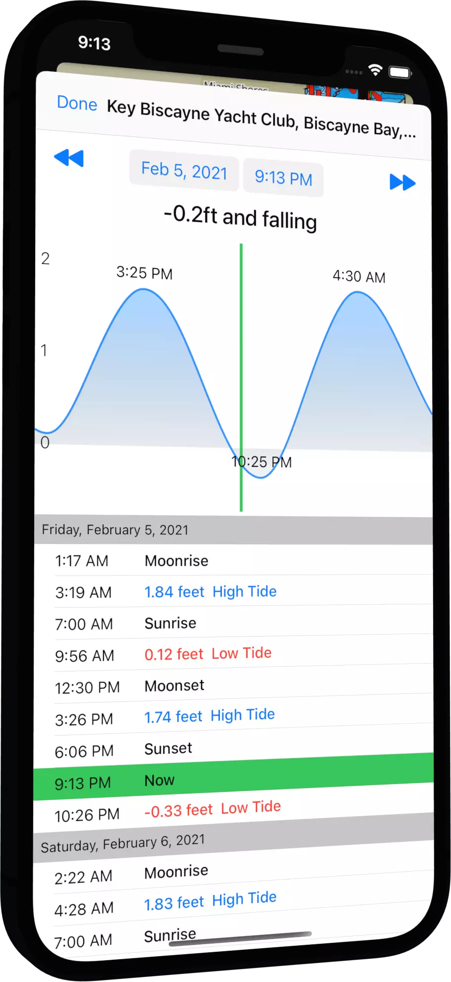
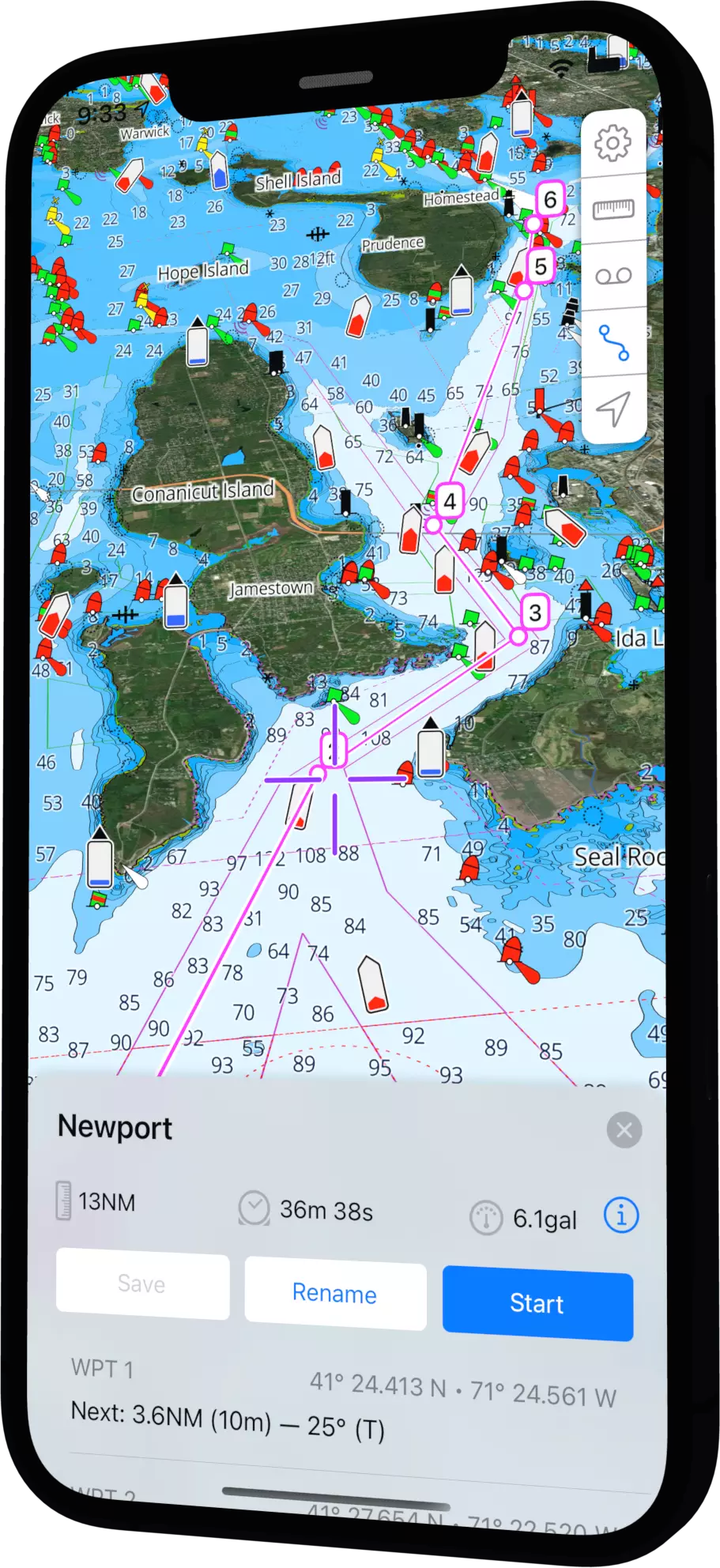
Tides & Currents
Check tides and currents without an internet connection. Visualize tides and currents for years into the future (or past) at more than 3000 locations around the US.
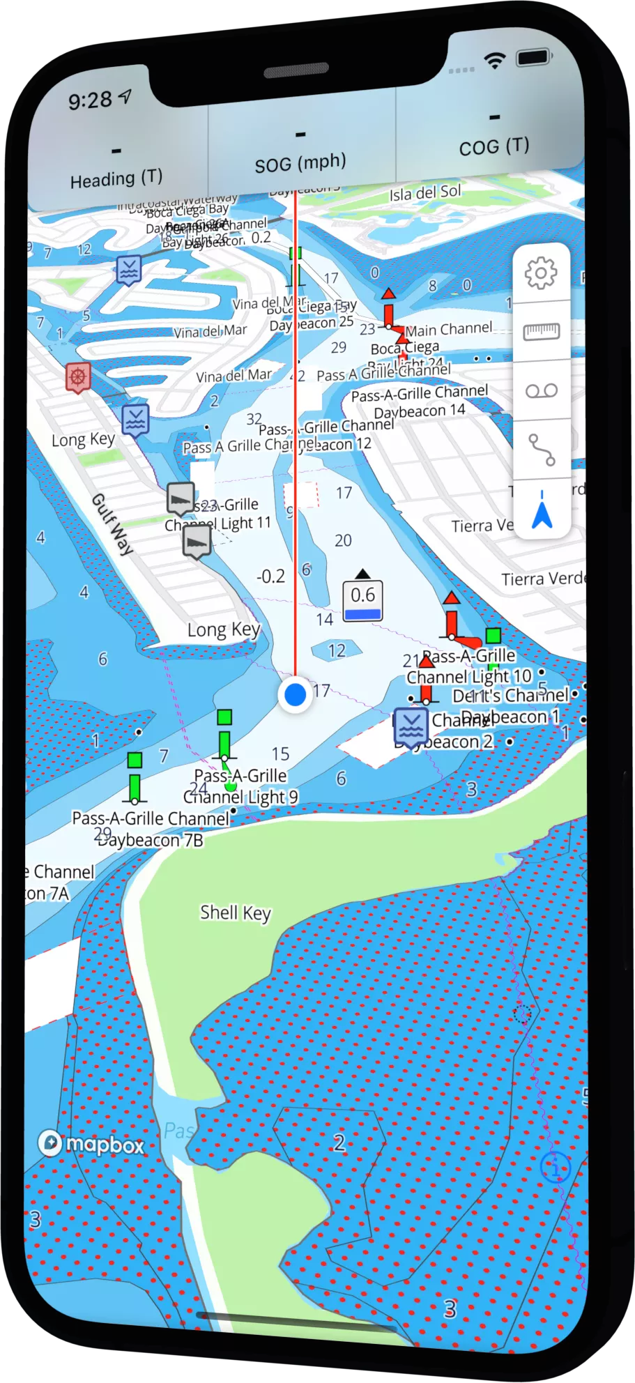
GPS Location
Turn on the GPS to instantly see your location on the chart. SeaDrive supports north up, course up, and heading up view modes. Your speed over ground is always available.
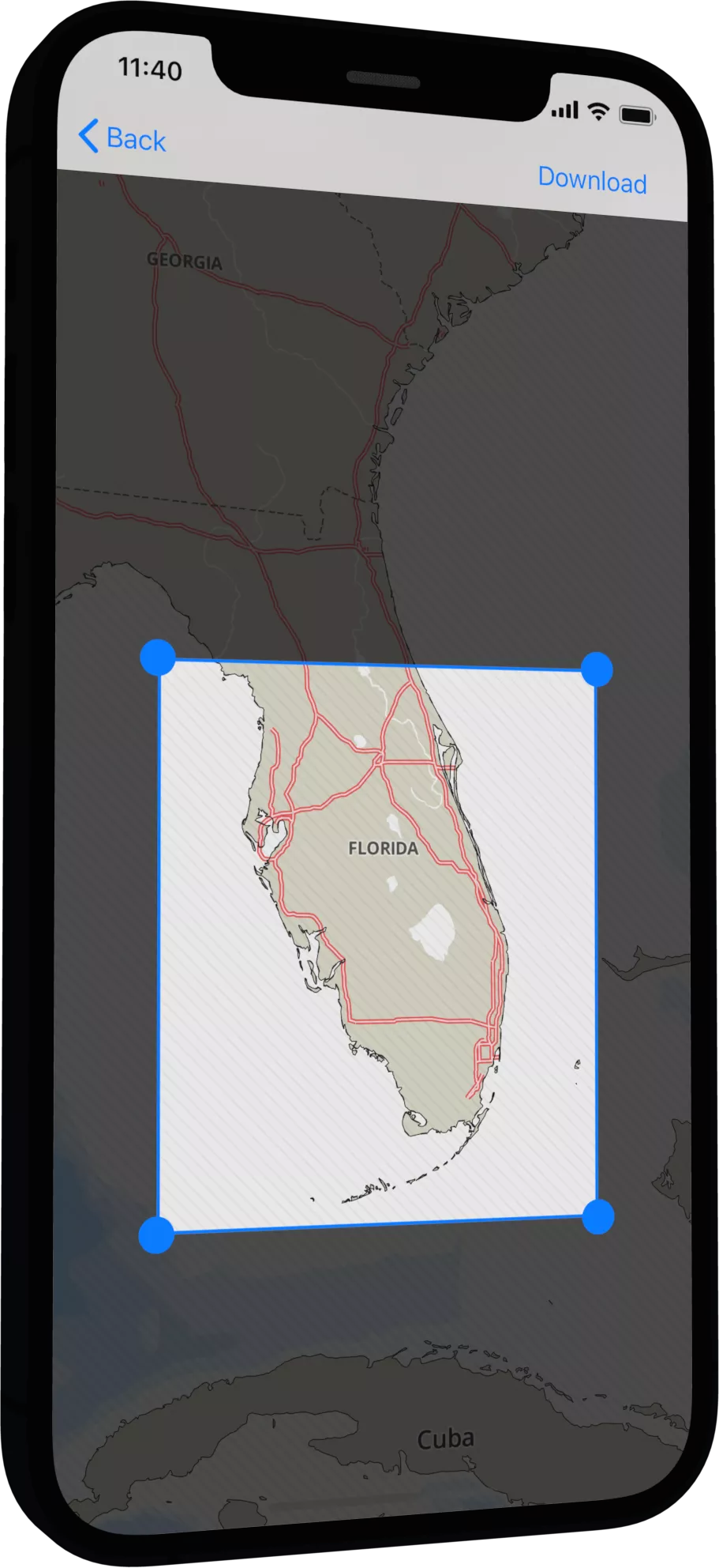
Offline Downloads
We know offline support is important, that's why it free. Download unlimited offline charts so you have access anywhere anytime.
Satellite Overlays
Enable satellite overlays for better navigational awareness and to help visualize your next destination whether it's a beach or a marina.
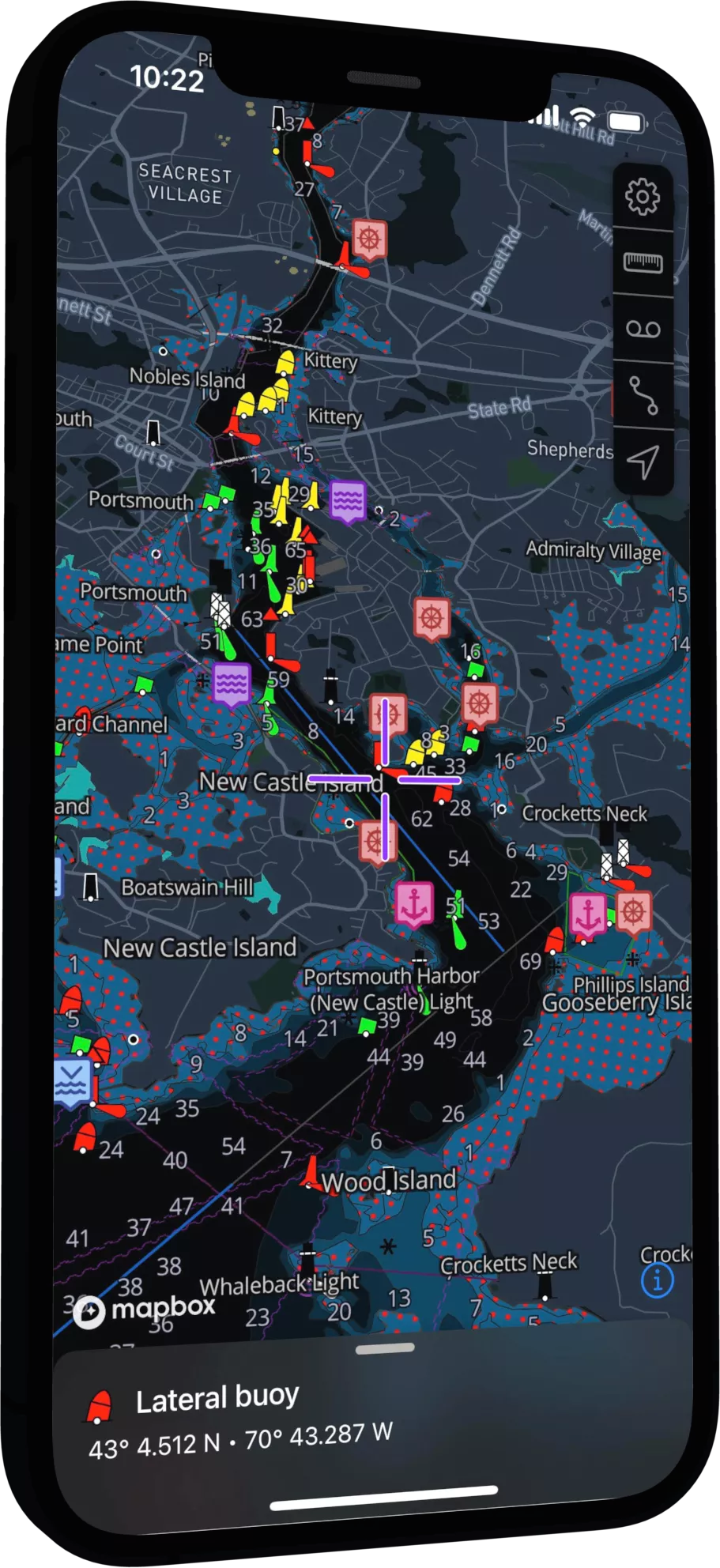
Dark Mode
Turn on dark mode during twilight or overnight passagemaking to improve night vision and situational awareness.
Want sweet product updates?
Android & iOS updates, product announcements, hit the subscribe.
We never share your data. Read our Privacy Policy.
And more awesome features!
Markers
Drop a pin on a secret fishing spot or any point of interest. Share or export your markers.
Routes
Build routes and customize waypoint names. Navigate and view ETA, SOG, and bearing to the next waypoint.
Tracks
Record, pause, and save your vessels location. Share and replay your routes or export a GPX file.
Distance Measurements
Use the caliper tool to measure the distance between points.
GPX Exports
Export routes, tracks, and markers as a GPX file for easy sharing with friends or compatible devices.
Heading Line
Orient your chart to course up mode and view a heading line overlaid on the chart.
Information Tool
Position the cursor and wipe up on the info panel to view details about anything on the chart.
Custom Depth Shading
Tailor the depth shading for your vessel type, be it a paddleboard or a deep keel sailboat.
Safety Depth
Set a custom safety depth and SeaDrive will show warnings about shallow areas.
Location Sharing
Share a link with friends for real time track updates, great for meeting up on the water.
Weather Data
Access weather forecasts including wind and swell/wave heights.
User Driven
We love feedback (especially the bad stuff). Contact us with requests and ideas. We might even build it!
Check Chart Charts
Free US Charts
SeaDrive provides chart coverage for the US, the Great Lakes, and US Territories. We'll expand more globally in the future and we promise to keep chart data at as low of a cost as possible.